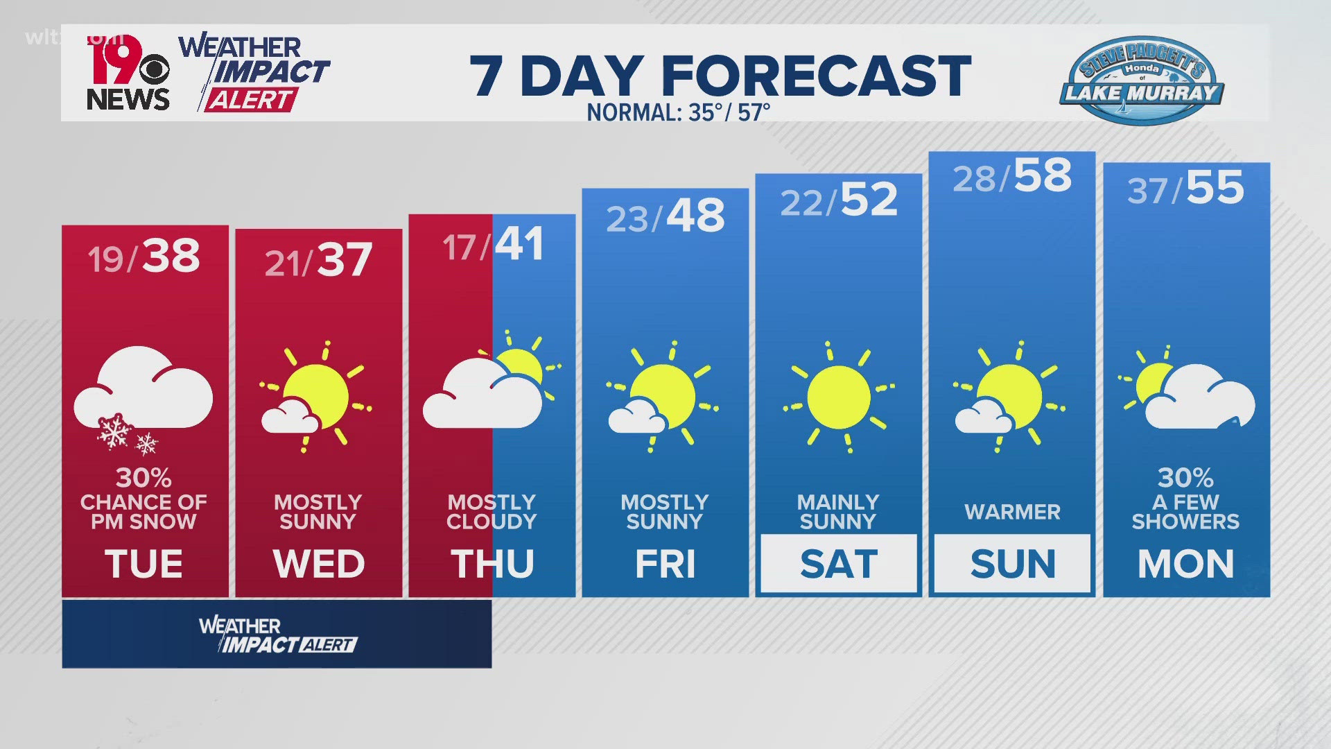

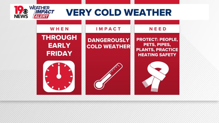
COLUMBIA, S.C. — This week will see well below normal temperatures across South Carolina, driven by an unusually deep trough and a strong surface high pressure system pushing an Arctic air mass into the region. While snow is possible in parts of the Midlands on Tuesday night, forecasts have trended drier. Cold weather is expected to persist through Friday, with temperatures gradually returning to near-normal levels by the weekend.
The Coldest Air Mass of the Season
The coldest air mass of the season is making its way into the area, accompanied by a cold weather advisory that will run until 10 a.m. Wednesday . Low temperatures in the teens were forecast for Wednesday and Thursday morning.
Tuesday’s Snow Chances Diminish
Although initial forecasts suggested potential snowfall Tuesday night, models now indicate a drier outcome. A shortwave trough, currently moving southward across the Sierra Nevada mountains, is expected to dig further into northern Mexico before heading eastward. This pattern, combined with the suppression of a potential coastal low, has significantly reduced snow chances for the region.
However, a winter weather advisory has been posted for the central and southern parts of Orangeburg County as well as Clarendon County. Those are the areas most likely to see an inch or so of snow, if that happens.
While clouds will increase throughout Tuesday, the very dry Arctic air mass will make it challenging for precipitation to form. Even with some upper-level lift, strong subsidence and cold air advection will likely prevent significant snowfall. Areas in the southeastern Midlands may see minimal impacts, with only a slight chance of light snow accumulation.

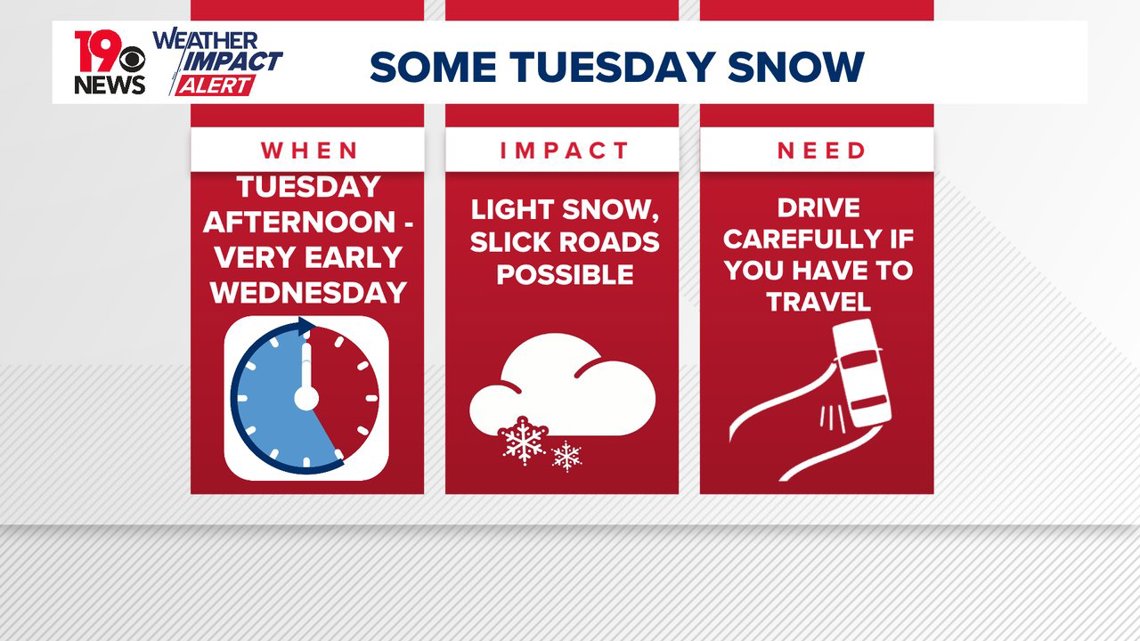
Our in-house forecast model (GRAF) is the outlier in the snowfall totals. The other models have indicated that the Midlands may get a dusting, with the southern Midlands possibly getting a little more. There are no winter storm watches or warnings in effect for the Midlands.
Extended Cold Spell Through Friday
The Arctic high will maintain its grip on the region through midweek, with daytime highs in the upper 30s to low 40s and nighttime lows in the teens or low 20s. Increasing clouds Wednesday night could moderate temperatures slightly, but radiational cooling under clear skies earlier in the night could push lows into the upper teens.

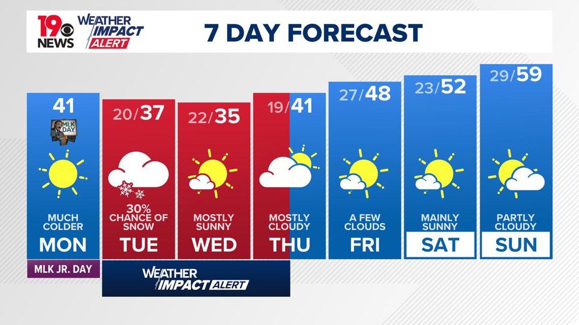
Another shortwave is expected to develop a coastal low off the Carolinas on Thursday night, bringing a slight chance of light precipitation. However, current models suggest limited impacts.
Gradual Warming by the Weekend
As the Arctic high shifts eastward, temperatures will begin to rebound over the weekend. Highs are expected to approach seasonal averages, with lows moderating as well. By early next week, rising heights in the upper atmosphere should usher in milder conditions, signaling the end of this extended cold snap.